How to Use Sunset Atlas
A quick tour of the map, point by point.
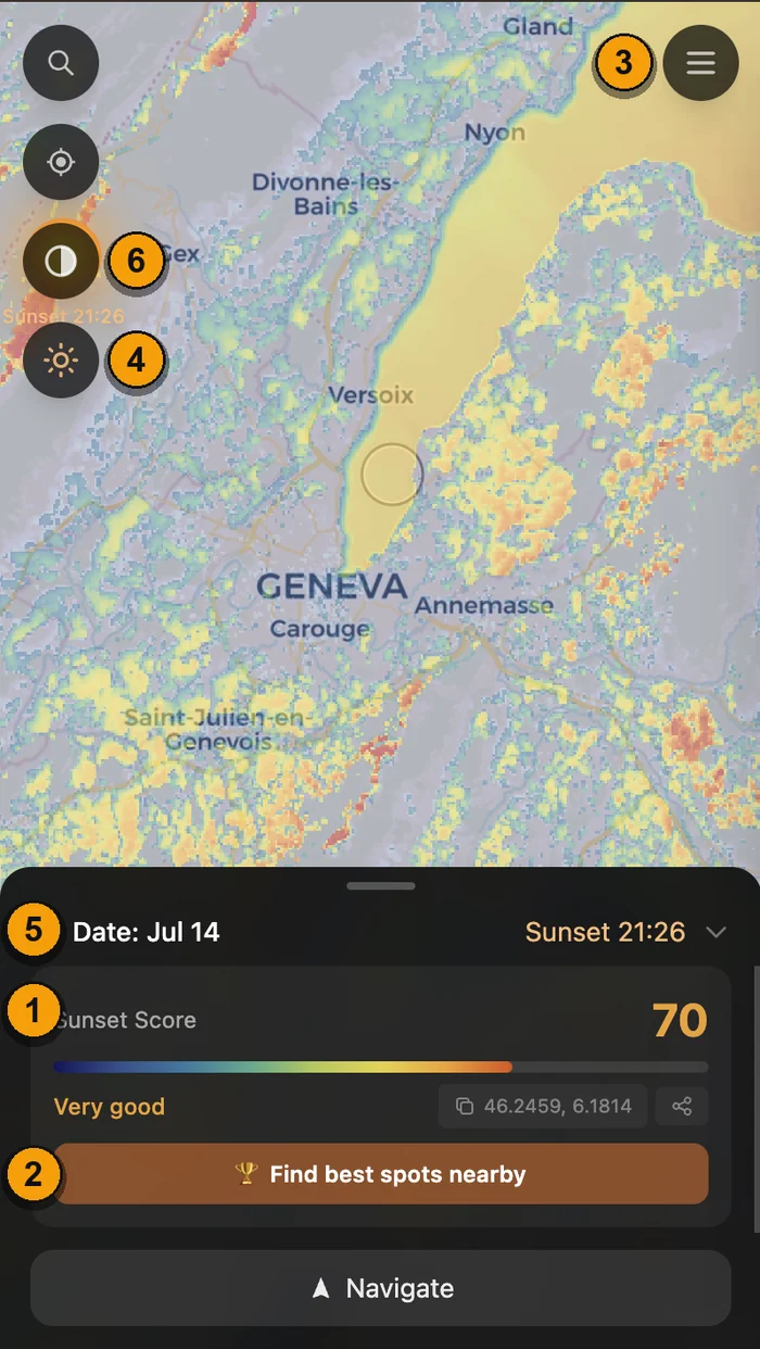
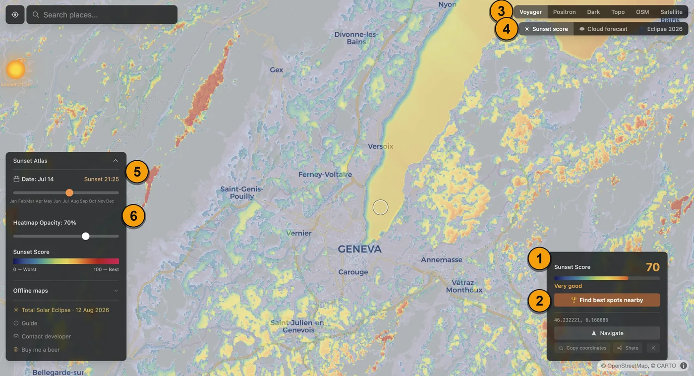
Sunset score
Click anywhere on the map to get a sunset score from 0 to 100. We look at the terrain (relief) and vegetation in the direction of the sunset, and calculate how open the horizon actually is from that exact spot. Blue and cool colors mean something blocks the view; orange and crimson mean a clear, memorable sunset.
For the full breakdown of how the score is calculated, see How it works.
Find best spots
Tap "Find best spots nearby" to search a radius around a point and rank the best sunset viewpoints for you, instead of scanning the heatmap by eye. You can also filter by distance to a road, path, or parking spot, so what comes back is somewhere you can actually reach.
Base maps
Switch the base map from the row of buttons (desktop) or the menu (phone).
- Voyager gives the clearest general overview, good for browsing.
- OSM and Topo show walking paths and elevation, useful for planning how to actually get there.
- Satellite shows the real vegetation on the ground. Tree cover already factors into the score, so this is more for double-checking a spot than for finding new ones.
Modes
Sunset Atlas has three modes.
- Sunset is the default: the 0-100 score described above, for any date of the year.
- Cloud switches to a live sky forecast, up to 2 days ahead. We only forecast 2 days out to keep the data reliable, since weather further out isn't accurate enough to be useful. See How we score the sky for the full model.
- Eclipse, built for 12 August 2026, checks whether the terrain leaves the low eclipse sun visible, which is a different question from whether it's a good sunset.
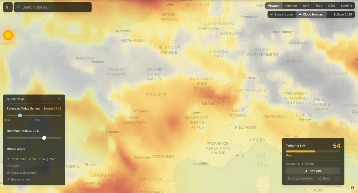
Date
Choose the date you'll actually be watching the sunset. The sun doesn't set in the same place every day, so the score updates to match that day's exact sun position. Drag the slider, or tap the calendar icon to jump straight to a date instead.
Heatmap opacity
The colored overlay sits on top of the base map, and at full strength it can hide what is actually underneath it. Turn the opacity down when you want to see the real terrain, a ridge, a patch of forest, whatever is driving a particular score at that spot.
A few more things worth knowing
Clicking anywhere on the map samples that exact spot and shows its full score breakdown. Search works with both place names and raw coordinates, and locate-me jumps to and scores wherever you are.
Once you've picked a spot, Navigate opens it directly in whichever maps app you actually use. If you're heading somewhere without signal, download the region first from the offline maps panel.
Sunset Atlas is also on iOS and Android, using the same map and the same scores.